For years the 3D view of our cities on digital maps has looked a bit like a model made of cardboard: recognizable shapes, but melted trees, blurry facades and a strong "video game" feeling. That is changing fast. With iOS 27, Apple has brought a major visual upgrade to Flyover, and everything suggests that behind it there is Gaussian Splatting in Apple Maps, the same technology that in the last three years has revolutionized 3D capture. Here is what happened, what we know for sure and what it means for those who promote a territory or a business.
What Apple announced
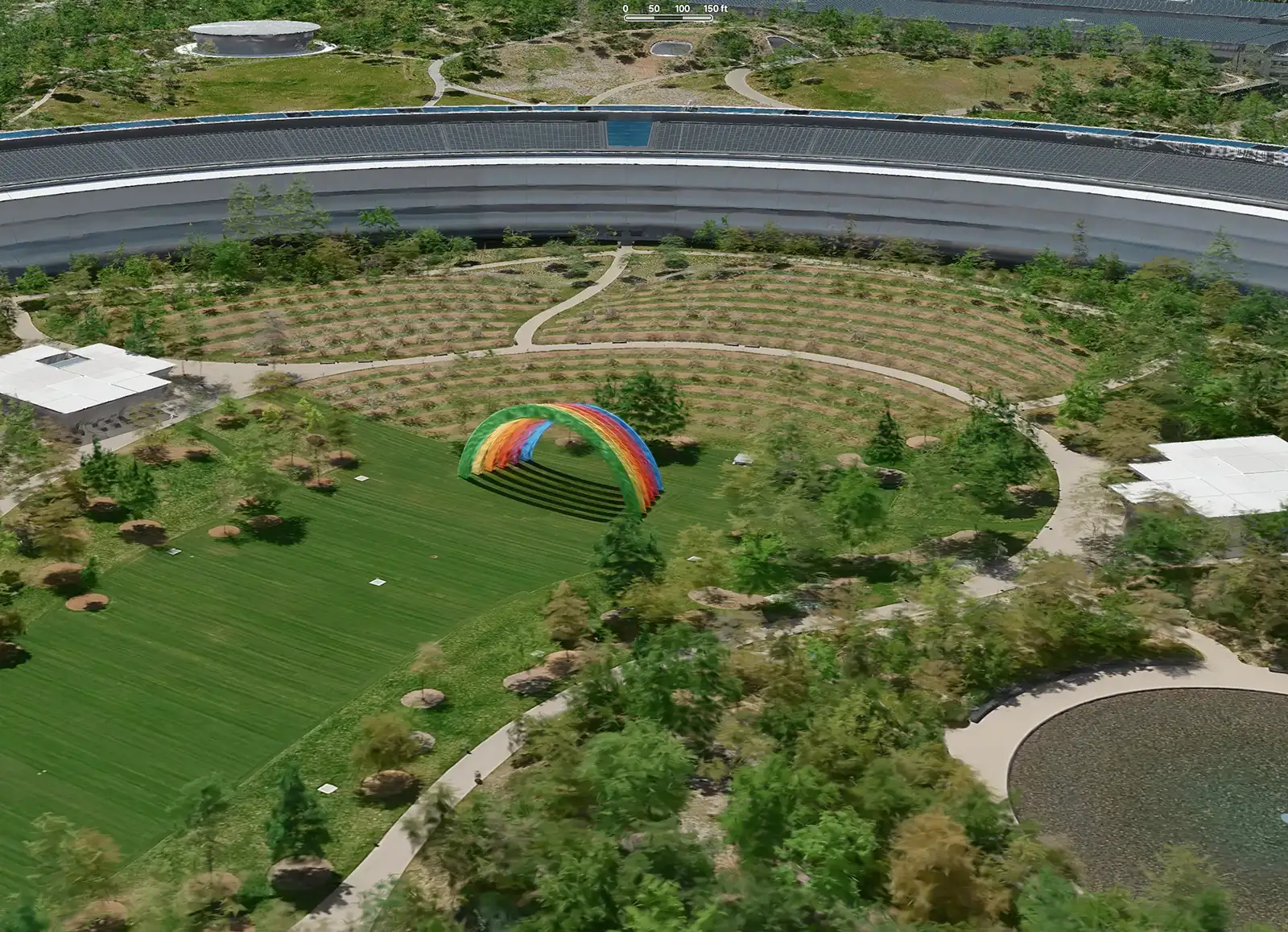
At WWDC in June 2026, Apple presented a significant fidelity boost for Flyover, the Apple Maps feature that lets you fly over cities and landmarks in 3D. Flyover covers more than 300 cities around the world and until now was based on traditional photogrammetry from aerial captures. According to Apple, the new version combines aerial imagery with its AI models to show buildings and landscapes in far greater detail, so that you will "see cities around the world like never before", in the words of Apple's Stacey Ford.
The update arrived with iOS 27, where Apple describes an enhanced Flyover with "imagery in stunning detail" in select cities around the world.
Is it really Gaussian Splatting?
Here it is important to be precise. Apple never used the words "Gaussian Splatting" in its presentation. However, the industry site Radiance Fields, which follows this technology closely, states that the new 3D views use a radiance field representation, and notes that Apple has been hiring engineers with Gaussian Splatting experience for years and already uses the same approach for Spatial Photos and Personas on Vision Pro. Analysts and users who studied the WWDC footage reached the same conclusion.
So: it is not officially confirmed, but the signals are strong. If confirmed, this would be one of the largest deployments of the technology ever, in the hands of hundreds of millions of people.
Why splats are perfect for maps
To understand why this matters, a quick recap. Gaussian Splatting describes a scene not with rigid polygons but with millions of tiny, soft, semi-transparent blobs of color. The result is much closer to a photograph than to a 3D model, and it can be shown in real time on an ordinary phone.
For a map this solves the historic problems of photogrammetry:
- Vegetation and complex shapes. Trees, hedges and gardens, which in classic 3D models look like melted plastic, become natural.
- Reflections and transparency. Glass, water and shiny surfaces look much more believable.
- Fine details. Balconies, cornices, roof tiles and street furniture are preserved instead of being smoothed out.
- Lightness. Scenes can be streamed and explored fluidly even on mobile devices.

And Google?
Google started down this road earlier. Its Immersive View in Google Maps has used radiance fields since 2023 to render routes and city areas in 3D. In March 2026 it launched Immersive Navigation, which uses Gemini models on Street View and aerial images to show buildings, lanes and terrain in 3D while driving. And on the Samsung Galaxy XR headset, Google Maps lets users walk through interior scenes of restaurants and cafés that, according to Radiance Fields, have all the characteristics of Gaussian splats, even though Google has not confirmed it either.
The direction is clear: the two largest map platforms in the world are moving from flat images and rough models to photorealistic 3D maps you can explore.
What it means for territories and businesses
This is the most interesting part for anyone who works in tourism, culture or local marketing.
The first visit happens on the map. More and more often, a traveler's first contact with a destination is a quick fly-over on their phone. When that fly-over looks like a real place and not a sketch, the map becomes a promotional showcase in its own right.
Expectations rise for everyone. When people get used to seeing their city in photographic 3D on Apple Maps, the flat photo gallery on a municipality's or hotel's website will look old. The quality bar has moved.
The big platforms cover the macro, not the micro. Flyover shows cities from above, in "select cities". It will not show the inside of a small church, the cellar of a winery, the alleys of a village of 800 inhabitants or the garden of a villa. This is where local operators come into play: those details must be captured, told and published by the territory itself.

Your own content becomes portable. Gaussian splats are becoming a standard format, supported by browsers, 3D software and headsets. A splat of a monument or a square made today can be shown on a website, in a VR experience at a fair or in an app, and will remain usable over time.
How to get ready
For municipalities, tourism boards and businesses, a few practical steps:
- Identify the places that maps will not show: interiors, small villages, hidden views, places that are closed or under restoration.
- Capture them in high quality with drones and cameras, thinking from the start about the formats needed for web, VR and social media.
- Publish them where people decide: on your website, on booking pages, in digital tourist offices.
- Tell a story around them, because a photorealistic 3D view is impressive for ten seconds, while a story keeps people for minutes.

The map becomes a window
With Apple's move, Gaussian Splatting leaves the circle of specialists and enters the daily life of millions of people, often without them even knowing the name. It is the clearest sign that photorealistic 3D is becoming the new normal for how we discover places. For those who promote a territory, it is both a challenge and an opportunity: the window is now open, and what appears inside it depends also on us.
Want to bring your destination or business into this new photorealistic 3D world? Contact us: we can capture and tell the places that maps cannot show.